Download the PHP package opensource-labs-gh/laravel-geo-utils without Composer
On this page you can find all versions of the php package opensource-labs-gh/laravel-geo-utils. It is possible to download/install these versions without Composer. Possible dependencies are resolved automatically.
Table of contents
Download opensource-labs-gh/laravel-geo-utils
More information about opensource-labs-gh/laravel-geo-utils
Files in opensource-labs-gh/laravel-geo-utils
Download opensource-labs-gh/laravel-geo-utils
More information about opensource-labs-gh/laravel-geo-utils
Files in opensource-labs-gh/laravel-geo-utils
Vendor opensource-labs-gh
Package laravel-geo-utils
Short Description A Laravel utility package for geographic polygon point checks with support for both PHP algorithms and MySQL spatial functions.
License MIT
Package laravel-geo-utils
Short Description A Laravel utility package for geographic polygon point checks with support for both PHP algorithms and MySQL spatial functions.
License MIT
FAQ
After the download, you have to make one include require_once('vendor/autoload.php');. After that you have to import the classes with use statements.
Example:
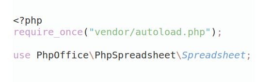
Example:
If you use only one package a project is not needed. But if you use more then one package, without a project it is not possible to import the classes with use statements.
In general, it is recommended to use always a project to download your libraries. In an application normally there is more than one library needed.
In general, it is recommended to use always a project to download your libraries. In an application normally there is more than one library needed.
Some PHP packages are not free to download and because of that hosted in private repositories.
In this case some credentials are needed to access such packages.
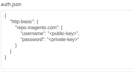
Please use the auth.json textarea to insert credentials, if a package is coming from a private repository.
You can look here for more information.
- Some hosting areas are not accessible by a terminal or SSH. Then it is not possible to use Composer.
- To use Composer is sometimes complicated. Especially for beginners.
- Composer needs much resources. Sometimes they are not available on a simple webspace.
- If you are using private repositories you don't need to share your credentials. You can set up everything on our site and then you provide a simple download link to your team member.
- Simplify your Composer build process. Use our own command line tool to download the vendor folder as binary. This makes your build process faster and you don't need to expose your credentials for private repositories.
Please rate this library. Is it a good library?
Informations about the package laravel-geo-utils
All versions of laravel-geo-utils with dependencies
PHP Build Version
Package Version

Requires
php Version
>=8.1
illuminate/support Version ^9.0|^10.0|^11.0|^12.0
illuminate/database Version ^9.0|^10.0|^11.0|^12.0
illuminate/support Version ^9.0|^10.0|^11.0|^12.0
illuminate/database Version ^9.0|^10.0|^11.0|^12.0
The package opensource-labs-gh/laravel-geo-utils contains the following files
Loading the files please wait ...