Download the PHP package darkclow4/filament-map-picker without Composer
On this page you can find all versions of the php package darkclow4/filament-map-picker. It is possible to download/install these versions without Composer. Possible dependencies are resolved automatically.
Download darkclow4/filament-map-picker
More information about darkclow4/filament-map-picker
Files in darkclow4/filament-map-picker
Package filament-map-picker
Short Description Leaflet map picker and GeoJSON draw field for Filament 5.
License MIT
Homepage https://github.com/darkclow4/filament-map-picker
FAQ
Example:
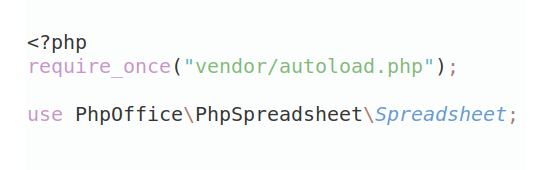
In general, it is recommended to use always a project to download your libraries. In an application normally there is more than one library needed.
- Some hosting areas are not accessible by a terminal or SSH. Then it is not possible to use Composer.
- To use Composer is sometimes complicated. Especially for beginners.
- Composer needs much resources. Sometimes they are not available on a simple webspace.
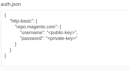
- If you are using private repositories you don't need to share your credentials. You can set up everything on our site and then you provide a simple download link to your team member.
- Simplify your Composer build process. Use our own command line tool to download the vendor folder as binary. This makes your build process faster and you don't need to expose your credentials for private repositories.
Informations about the package filament-map-picker
Filament Map Picker
filament-map-picker provides Filament 5 form, infolist, and widget components powered by Leaflet.js. Use it to select a point location in forms, draw one or more map areas as GeoJSON, and display saved locations in read-only infolists or dashboard widgets.
The package is designed to stay flexible. It does not force how you persist latitude, longitude, or area data. Instead, it keeps a predictable field state and lets you map the values however you want through afterStateUpdated() and afterStateHydrated().
Features
- Built for Filament 5
- Powered by locally bundled Leaflet.js and Leaflet Draw
- Form field, infolist entry, and dashboard widget APIs
- Default OpenStreetMap tile layer
- Custom tile support through
->tiles([...]) dragmode andclickmode for the point marker- Optional geocoding search UI
- Optional polygon, rectangle, and circle drawing tools
- Optional multi-shape GeoJSON collections
- Combined point + area state in a single field
- Reactive Livewire-friendly state updates
- Alpine.js powered interaction
- Leaflet layers control for switching tile layers
- Read-only map rendering for detail pages and dashboards
Requirements
- PHP 8.3+
- Laravel 13+
- Filament 5
Installation
Install the package with Composer:
Then publish Filament assets:
Package Registration
The package supports Laravel auto-discovery through:
In most applications, no manual provider registration is needed.
State Format
Point-only mode
By default, the field stores point coordinates as:
Point + draw mode
When draw mode is enabled, the field stores a combined state:
This makes it easy to keep a marker location and one or more service-area shapes in the same field while still saving them into separate database columns.
Basic Usage
Point-only form field
Point + area in a single field
Read-only infolist entry
Use MapEntry when you want to display saved coordinates on view/detail pages.
Add ->interactive() if you want the user to pan and zoom around the point without changing the saved state.
For saved GeoJSON areas, enable ->drawable() and include geojson in the state:
Dashboard map widget
Use MapWidget directly when the state is passed from a page or dashboard:
For dynamic configuration, create your own widget class and extend the package widget:
Selection Modes
Drag mode
- the user drags the map
- the marker stays centered
- coordinates are taken from the map center
Click mode
- the user clicks on the map
- the marker moves to the clicked point
- coordinates are taken from that point
Default Tile Layer
If you do not provide custom tiles, the field uses OpenStreetMap automatically.
Built-in default tile definition:
Custom Tile Layers
You can provide your own tile layers with ->tiles([...]). Those definitions are serialized to JSON and passed directly to Leaflet.
Tile behavior:
- if
->tiles()is not called, onlyosmis available - if
->tile()is not called,osmis selected by default - if the selected tile key is invalid, the field falls back to
osm - if more than one base layer exists, Leaflet's built-in layers control is shown on the map
- by default the built-in
osmtile is always included - use
->showDefaultTile(false)if you want to hide the built-inosmtile and only expose your custom tiles
Searchable Mode
Enable geocoding search when you want users to jump quickly to a location:
Behavior:
- users can search for a place or address
- matching results appear in a dropdown list
- selecting a result recenters the map and updates the field state
- selected results are highlighted when reopened
By default, search uses:
You can override it:
Drawing Shapes as GeoJSON
Enable draw mode when you want the user to define areas while keeping a marker location in the same field state.
Notes:
- draw mode stores the field state as
['lat', 'lng', 'geojson'] - the marker location still works as normal
- the drawn area is stored inside
geojson - by default only one drawn shape is kept at a time
- use
->multipleShapes()if you want multiple polygons / rectangles / circles in the sameFeatureCollection - editing or deleting shapes updates the field state automatically
- use
afterStateUpdated()/afterStateHydrated()to maplatitude,longitude, andgeojsoninto separate database columns
API Reference
Unless noted otherwise, these configuration methods are available on:
Darkclow4\FilamentMapPicker\Forms\Components\MapPickerDarkclow4\FilamentMapPicker\Infolists\Components\MapEntryDarkclow4\FilamentMapPicker\Widgets\MapWidget
->tile(string $tile)
Sets the active tile key.
->tiles(array $tiles)
Registers custom tile layers.
Expected tile format:
->showDefaultTile(bool $condition = true)
Controls whether the built-in osm tile should be included in the available tile list.
->interactive(bool $condition = true)
Allows a read-only map to remain draggable and zoomable without syncing state back to Livewire.
->mode('drag|click')
Defines the point marker interaction mode.
->defaultLocation(float $lat, float $lng)
Sets the initial map coordinates.
->zoom(int $level)
Sets the initial map zoom level.
->height(int|string $height)
Sets the map container height.
->markerColor(string $color)
Sets the marker color used in both drag and click modes.
->searchable(bool $condition = true)
Enables place search. This is only available on the form field.
->searchPlaceholder(string $placeholder)
Overrides the search input placeholder.
->searchProviderUrl(string $url)
Overrides the geocoding endpoint used by the search box.
->searchResultLimit(int $limit)
Controls how many search results are shown in the dropdown.
->drawable(bool $condition = true)
Enables shape drawing tools and switches the field state into combined point + GeoJSON mode.
->drawTools(array $tools)
Controls which draw tools are available. Supported values are polygon, rectangle, and circle.
->fitDrawBounds(bool $condition = true)
Controls whether the map should automatically fit to the drawn shapes after create or edit.
->multipleShapes(bool $condition = true)
Allows the field to keep multiple drawn shapes inside the GeoJSON FeatureCollection.
->showAreaMeasurement(bool $condition = true)
Shows area labels directly inside the map for each drawn shape when draw mode is enabled.
->areaMeasurementUnit('m2'|'ha')
Controls the unit used for the displayed area measurement.
Notes
- The package does not force any persistence strategy for
latitude,longitude, or area GeoJSON - You are free to map the field state into any schema structure you prefer
- Custom tiles are the developer's responsibility, including availability and usage terms
- Search providers are the developer's responsibility, including availability and usage terms
License
This package is open-sourced software licensed under the MIT license.
All versions of filament-map-picker with dependencies

filament/filament Version ^5.0
illuminate/contracts Version ^13.0
spatie/laravel-package-tools Version ^1.92