Download the PHP package longitude-one/spatial-types without Composer
On this page you can find all versions of the php package longitude-one/spatial-types. It is possible to download/install these versions without Composer. Possible dependencies are resolved automatically.
FAQ
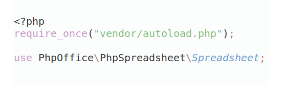
Example:
In general, it is recommended to use always a project to download your libraries. In an application normally there is more than one library needed.
- Some hosting areas are not accessible by a terminal or SSH. Then it is not possible to use Composer.
- To use Composer is sometimes complicated. Especially for beginners.
- Composer needs much resources. Sometimes they are not available on a simple webspace.
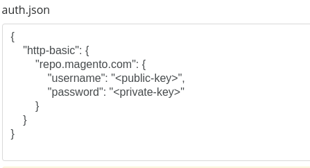
- If you are using private repositories you don't need to share your credentials. You can set up everything on our site and then you provide a simple download link to your team member.
- Simplify your Composer build process. Use our own command line tool to download the vendor folder as binary. This makes your build process faster and you don't need to expose your credentials for private repositories.
Informations about the package spatial-types
Spatial Types Library
PHP library providing spatial types and their geometric and geographic classes.
If you want to persist spatial data in a database, you should use the longitude-one/doctrine2-spatial package.
Current status


Installation
Usage
For the complete catalogue of concrete types, constructors, accessors, and mutability rules, see Instantiable spatial types.
Type class hierarchy
The following tree describes class inheritance in Types, rather than the
file layout. Intermediate abstract classes are hidden; only
AbstractSpatialType and instantiable classes are shown. {Dimension2, Dimension3m, Dimension3z, Dimension4zm} represents one branch for each listed
coordinate dimension and {Geometry, Geography} one concrete class for each
spatial model. For the complete hierarchy, including intermediate abstract
classes, see Type class hierarchy.
Types not yet available
CurvePolygon, MultiCurve,
MultiSurface and TIN do not yet have
instantiable classes. See Instantiable spatial types
for the complete coverage matrix.
Immutability
Spatial values are immutable and safe to share: their coordinates, SRID, and
aggregate membership are set at construction time and never changed through
the public API. Use withCoordinates() with an immutable Value\Coordinates
value to represent another location, or withSpatialReference() to associate
the same coordinates with another declared reference. Both return new objects.
LineString, Polygon, Triangle, and PolyhedralSurface also provide
withArrayOfCoordinates() to create a new instance with replacement
coordinates. This preserves their family, dimension, and SRID without changing
the source object.
This prevents a value shared by other aggregates from silently changing them. See Immutability for the rationale, examples, and the complete contract.
Spatial reference system (SRS)
Every spatial object has a Reference\SpatialReference. Its legacy integer
projection remains available through getSrid(), while getSpatialReference()
preserves the optional authority (for example EPSG:4326). Constructors and
factories accept either a legacy integer or a SpatialReference instance.
Supplied members retain their declared references; compatibility is not
validated automatically. Use withSpatialReference() (or the legacy
withSrid()) to relabel a copy and its descendants without reprojection.
See Spatial reference systems for reference handling, and Spatial validation for the separation of representation from explicit functional validation.
All versions of spatial-types with dependencies

longitude-one/geo-parser Version ^4.1
longitude-one/spatial-core Version ^1.3