Download the PHP package drakelid/librenms-weather-risk-map-widget without Composer
On this page you can find all versions of the php package drakelid/librenms-weather-risk-map-widget. It is possible to download/install these versions without Composer. Possible dependencies are resolved automatically.
Download drakelid/librenms-weather-risk-map-widget
More information about drakelid/librenms-weather-risk-map-widget
Files in drakelid/librenms-weather-risk-map-widget
Package librenms-weather-risk-map-widget
Short Description Weather Risk Map dashboard widget for LibreNMS - correlates device GPS coordinates with forecasts and official severe-weather warnings from MET Norway
License GPL-3.0-or-later
Homepage https://github.com/Drakelid/weather-risk-map-widget
FAQ
Example:
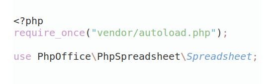
In general, it is recommended to use always a project to download your libraries. In an application normally there is more than one library needed.
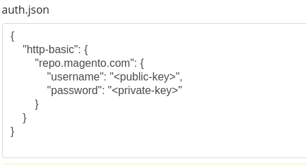
- Some hosting areas are not accessible by a terminal or SSH. Then it is not possible to use Composer.
- To use Composer is sometimes complicated. Especially for beginners.
- Composer needs much resources. Sometimes they are not available on a simple webspace.
- If you are using private repositories you don't need to share your credentials. You can set up everything on our site and then you provide a simple download link to your team member.
- Simplify your Composer build process. Use our own command line tool to download the vendor folder as binary. This makes your build process faster and you don't need to expose your credentials for private repositories.
Informations about the package librenms-weather-risk-map-widget
Weather Risk Map
A LibreNMS dashboard widget that shows which network sites are about to be hit by bad weather.
It reads the GPS coordinates already stored on your LibreNMS devices, correlates them with forecasts and official severe-weather warnings, and reports an infrastructure risk level — not a weather report.
| LibreNMS | 26.7.0-68-g1dfe1994d |
| PHP | ^8.2 |
| Laravel | ^12.10 |
| Core files modified | none |
| Database changes | none |
| JS dependencies | none (Leaflet ships with LibreNMS) |
| Licence | GPL-3.0-or-later |
Contents
- Quick start
- Risk levels
- How it works
- Weather data sources
- Installation
- Configuration
- The risk algorithm
- Map and UI behaviour
- Testing
- Troubleshooting
- Files created and modified
- Known limitations
- Future improvements
- Verification status
1. Quick start
[!IMPORTANT] Run every command as the
librenmsuser (sudo su - librenmsfirst). LibreNMS refuses artisan as anyone else, and running it as root or your own account leaves cache files the web server cannot write — which surfaces later as an unrelated-looking 500.There is usually no
composeron PATH. Use LibreNMS's own wrapper:php scripts/composer_wrapper.php …
First get the package onto the server, beside the LibreNMS directory:
Then, as librenms, from /opt/librenms:
Add one required line to .env:
Then clear caches and verify:
Add it to a dashboard: Overview → edit (pencil) → Add Widget → Weather Risk Map.
[!IMPORTANT] The
.envline is not optional. MET Norway answers 403 to any request whoseUser-Agentlacks a real contact email.weather-risk-map:diagnosefails loudly while the shipped placeholder is still in place.[!CAUTION] A LibreNMS core update will uninstall this plugin.
daily.shrunsgit checkout -- composer.json composer.lock, which destroys the path repository above. See §5 before putting this into production — it is not optional operational trivia, the widget silently disappears.
Full details in §5 Installation.
[!TIP] Deploying to a live LibreNMS server? Follow docs/PRODUCTION-INSTALL.md instead — a step-by-step guide including backups, verification, the persistence guard and a rollback procedure.
2. Risk levels
| Level | Meaning | |
|---|---|---|
| 🟢 | Normal | No significant risk |
| 🔵 | Info | Informational / minor weather |
| 🟡 | Moderate | Yellow-warning territory |
| 🟠 | High | Orange-warning territory |
| 🔴 | Severe | Red-warning territory |
| 🟣 | Extreme | Two or more hazards at Severe |
[!NOTE] Marker fill is weather risk. LibreNMS operational status is drawn separately — a device that is down keeps its weather colour and gains a dark border. The two are never conflated.
3. How it works
The widget renders before its data
The dashboard requests each widget over AJAX and swaps in the returned HTML. If the widget controller waited on the weather APIs, a slow provider would visibly stall it.
So the widget controller performs no weather I/O at all. The shell paints immediately and fetches its payload separately.
Device count does not drive API traffic
Three collapses happen in sequence:
| # | Collapse | Effect |
|---|---|---|
| 1 | Devices → LibreNMS locations rows |
A POP with 40 switches is one coordinate |
| 2 | Locations → geographic grid cells | Sites a forecast cannot distinguish share one lookup |
| 3 | Warnings → one national request | Matched to devices locally, point-in-polygon |
A 2,000-device Norwegian ISP across ~150 sites typically resolves to 30–60 forecast requests per 15 minutes, plus one warnings request per 5 minutes. Both are cached, so a NOC wall with eight browsers open generates the same traffic as one.
A hard max_cells_per_refresh ceiling bounds the worst case. Cells beyond it reuse cached data rather than being dropped.
The cache has two tiers
Every entry is written twice:
fresh:— short TTL, the normal serving copystale:— long TTL, the failure fallback
A single-tier cache loses its data exactly when the provider goes down and you need it most. On failure the widget serves the stale copy and labels it with its age. A failure marker additionally stops a dead provider being retried by every dashboard refresh from every logged-in operator.
4. Weather data sources
MET Norway — primary (met-norway)
| Product | Endpoint | Used for |
|---|---|---|
| Locationforecast 2.0 | …/locationforecast/2.0/compact |
Point forecast, per geo cell |
| MetAlerts 2.0 | …/metalerts/2.0/current.json |
Every active Norwegian warning as GeoJSON polygons, in one request |
Chosen because it is authoritative for Norway, it is the only candidate publishing official warning polygons with severity, and MetAlerts' single-request national coverage is what makes local polygon matching possible.
Terms-of-service compliance is implemented, not just intended:
- ✅ Identifying
User-Agentwith a contact email — MET returns 403 without one - ✅ Coordinates truncated to 4 decimals — MET returns 403 with more
- ✅
Expireshonoured —heldByExpires()refuses to re-request inside the window even when the local TTL is shorter - ✅
If-Modified-Sincesent with the exact previousLast-Modified; a304refreshes the TTL without re-downloading - ✅ 20 req/s application-wide — geo-cell grouping keeps us orders of magnitude below it
- ✅ CC BY 4.0 attribution rendered in the widget footer
Open-Meteo — secondary (open-meteo)
Kept behind the same interface for two reasons:
- Its forecast endpoint accepts comma-separated coordinate lists, so all cells arrive in one request.
- It gives worldwide coverage for devices outside MET Norway's warning area.
It publishes no official warnings, so supportsWarnings() returns false and warnings keep coming from MET Norway.
Lightning — an honest limitation
[!WARNING] No free, reliable public API provides real-time lightning strike data.
Lightning is modelled as risk from thunder indications in the forecast — probability_of_thunder where available, otherwise the …andthunder symbol suffix. It is flagged inferred in the payload and rendered as "(risk, not detected strikes)" in the UI. Nothing is presented as a detected strike.
5. Installation
Leaflet and Leaflet.markercluster are already bundled with LibreNMS (html/js/leaflet.js, html/js/leaflet.markercluster.js), and the widget reuses core's init_map() / get_map() / destroy_map() helpers. There are no JavaScript dependencies and no asset build step.
Prerequisites that are easy to get wrong
| User | Every artisan / lnms / composer command runs as librenms. Start with sudo su - librenms. |
| Composer | Usually not on PATH. Use php /opt/librenms/scripts/composer_wrapper.php (it downloads composer.phar if the system has no Composer). |
| Location | The package must exist on the server. ../weather-risk-map-widget resolves relative to the LibreNMS directory, i.e. /opt/weather-risk-map-widget. |
| Ownership | sudo chown -R librenms:librenms /opt/weather-risk-map-widget, or git refuses with "detected dubious ownership" and pulls silently fail. |
Steps
Set the contact email — required, see §1:
Then: Overview → dashboard → edit (pencil) → Add Widget → Weather Risk Map.
Verify the route registered — this is the single best health check, because a missing route renders as core's generic "Problem with backend":
Surviving a LibreNMS core update
[!CAUTION] Installed this way, the plugin will be removed by the next nightly update.
daily.sh does the following, in order:
composer.json is tracked in LibreNMS's git, so the checkout destroys the path repository. LibreNMS then re-requires the plugin by name from composer.plugins.json — but composer_get_plugins in daily.php reads only the require block and ignores any repositories you add there. With no repository, the package cannot resolve and is dropped.
The same pass runs --update-no-dev, which strips LibreNMS's dev dependencies. That removes PHPUnit and breaks the flare log driver in the default logging stack, so subsequent errors are not written to laravel.log at all — which makes the failure considerably harder to diagnose than it should be.
Three ways to handle it:
1. Publish the package (the real fix). If drakelid/librenms-weather-risk-map-widget resolves from Packagist, daily.sh's composer require works untouched and no repository entry is needed anywhere. A path repository is a development arrangement; this is what LibreNMS's plugin system expects.
2. Re-apply automatically. Idempotent, so it is safe hourly regardless of when daily.sh runs:
3. Disable automatic updates — arguably correct for a NOC system anyway:
[!NOTE] Defining the repository in Composer's global config does not work. Composer documents only disabling a repository globally; there is no supported way to define one that applies to another project. This was tested and failed.
Notes
- If your installation caches config or routes, re-run
php artisan config:cache/route:cacheafter clearing. -
No service restart is needed beyond the cache clears — unless you run OPcache with
validate_timestamps=0, in which case reload PHP-FPM: - After a
git pullin the package directory, runphp artisan view:clear(oroptimize:clear) and hard-refresh the browser. The widget's CSS and JavaScript are inlined into the Blade output, so a cached page keeps running the old script.
Optional: pre-warm the cache
Worth it only for a permanently displayed NOC dashboard. Deliberately not scheduled by default, so an installation that never opens the widget generates no API traffic:
6. Configuration
Widget settings
Per widget, per user — edited in the widget's own settings panel.
| Group | Setting | Options | Default |
|---|---|---|---|
| General | Widget title | free text | Weather Risk Map |
| Device groups | multi-select, empty = all | All | |
| Risk period | Current / 3 / 6 / 12 / 24 / 48 h | 24 h | |
| Minimum displayed severity | All / Moderate+ / High+ / Severe+ | All | |
| Refresh interval | seconds | 600 | |
| Map | Default map mode | Auto-fit devices / Remember last position | Auto-fit |
| Weather risk radius | 1 / 5 / 10 / 25 / 50 km | 10 km | |
| Marker clustering | on / off | on | |
| Show warning polygons | on / off | on | |
| Hazards | Wind, Storm, Lightning, Rain, Flood, Snow, Icing, Heat, Cold | on / off each | all on |
| Thresholds | numeric, per hazard × moderate/high/severe | blank = installation default | see §7 |
[!NOTE] On the refresh field. The spec suggested a 5/10/15/30/60-minute dropdown. The panel instead inherits LibreNMS's own numeric refresh input from
widgets.settings.base, because that is the convention every other widget follows and what core's save path validates. The default is 600 s (10 min) as specified; any value is accepted.
Installation config
config/weather-risk-map.php — provider selection, User-Agent, language, cache TTLs, HTTP timeout, request budget, default thresholds and sensitivity profiles. Every value is overridable by environment variable.
Infrastructure sensitivity
Shifts individual hazards up or down for devices in a given LibreNMS device group. Ships empty, so nothing changes until you opt in.
Profiles reference device groups by numeric id, never by name:
Find your group ids with:
Offsets shift the hazard on the 0–5 scale and are clamped at both ends. When a device belongs to several profiled groups the largest offset wins — erring toward showing more risk, never less.
7. The risk algorithm
Fully documented in the class docblock of src/Services/WeatherRiskService.php. In summary:
1 — Calculated risk. Every forecast hour in the window is scored against configurable thresholds per hazard. The result is the worst hour and the time it occurs. Wind scores sustained speed and gusts on separate scales, because a 25 m/s gust in a 12 m/s wind is a different engineering problem from steady 25 m/s.
2 — Official warning risk. Warnings whose polygon contains the device, and whose validity overlaps the window, contribute their published severity: yellow → Moderate, orange → High, red → Severe.
3 — Combination.
Official warnings raise but never lower a calculated risk — a genuinely dangerous local value is not suppressed just because no warning was issued. When calculated risk wins, the assessment is still flagged official so the operator sees a warning exists.
4 — Sensitivity. Device-group offsets applied.
5 — Escalation. Two or more hazards at Severe promote the device to Extreme 🟣. Compound events are what actually take sites off the air.
Default thresholds
All overridable per widget.
| Hazard | 🟡 Moderate | 🟠 High | 🔴 Severe |
|---|---|---|---|
| Wind, sustained (m/s) | 12 | 18 | 25 |
| Wind gusts (m/s) | 17 | 24 | 32 |
| Rain (mm/h) | 4 | 8 | 15 |
| Rain, accumulated (mm) | 20 | 40 | 70 |
| Snow (mm water eq.) | 5 | 12 | 25 |
| Thunder probability (%) | 15 | 40 | 70 |
| Heat (°C, at or above) | 30 | 35 | 40 |
| Cold (°C, at or below) | −10 | −20 | −30 |
Icing is derived from the physical precondition — precipitation while air temperature sits in the −6 °C … +1 °C band — and is flagged inferred.
8. Map and UI behaviour
- Marker colour = weather risk. LibreNMS down state is a dark double border; disabled devices are dimmed. Never conflated.
- Clusters take the colour of their worst member, so one red site among 26 green ones stays visible when zoomed out.
- Warning polygons use 16 % fill opacity and sit behind the markers, so devices stay readable underneath.
- Warning popups show type, severity, official title, description, consequences, recommendations, start/end, source and fetch time — each rendered only if the source actually published it. Nothing is fabricated.
- Automatic positioning fits the bounds of the visible devices; a single device gets zoom 11. No country or city is hard-coded.
- Summary counters are clickable severity filters; hazard chips toggle hazards client-side.
- Table rows are clickable and centre/zoom the map on that device, expanding its cluster first.
- Dark mode. Leaflet ships hard-coded light chrome, so popups, tips, bars, layer control and attribution are each re-declared for the dark theme, and tiles get a slight brightness reduction so markers stay legible.
9. Testing
Automated
The package keeps its own vendor/, so the suite is unaffected when a
LibreNMS update strips core's dev dependencies:
Expected: OK (110 tests, 264 assertions).
The suite is pure — no database, no Laravel application, no network — so it runs
anywhere PHP 8.2+ is available. vendor/bin/pint --test checks style.
[!NOTE]
composeris usually not on PATH on a LibreNMS host, andscripts/composer_wrapper.phpalwayschdirs to/opt/librenms, so it cannot be used for this package. Invokecomposer.phardirectly as above.
Coverage against the specification's test matrix
| Area | Covered by | | --- | --- | | Valid / missing / invalid / duplicate coordinates, `0,0`, out-of-range, NaN | `CoordinateTest` | | Polygon containment, holes, concave shapes, MultiPolygon, malformed geometry, simplification | `PolygonTest`, `WeatherGeoServiceTest` | | No warnings / yellow / orange / red / multiple simultaneous | `WeatherRiskServiceTest`, `MetNorwayParsingTest` | | `max(calculated, official)` in both directions | `WeatherRiskServiceTest` | | Thresholds, gusts, peak-hour selection, null ≠ zero | `WeatherRiskServiceTest` | | Sensitivity offsets, positive and negative | `WeatherRiskServiceTest` | | Device grouping, 1000 devices → few cells | `WeatherGeoServiceTest` | | Malformed response, missing fields, unparseable times | `MetNorwayParsingTest` | | Cached fallback, provider throw, provider null, failure backoff | `WeatherCacheServiceTest` | | Settings validation, XSS in title, injection in group ids, range clamping | `WidgetSettingsTest` |Static and syntax checks
Run on the LibreNMS host, where PHP is available:
Manual NOC checks
| # | Check | Expected |
|---|---|---|
| 1 | php artisan weather-risk-map:diagnose |
Forecast OK, warning count reported |
| 2 | Block api.met.no at the firewall, refresh |
Devices still shown + "cached data N minutes old" badge — never an empty widget or a Laravel error page |
| 3 | Set WEATHER_RISK_MAP_TIMEOUT=1 |
Widget degrades, does not hang |
| 4 | Hit the data endpoint > 60×/min | Throttled message, not a stack trace |
| 5 | Take a device down | Keeps its weather colour, gains the dark border |
| 6 | Set a device-group filter | Only that group's members appear |
| 7 | Toggle light / dark theme | Popups, table, controls, polygons, overlays all legible |
| 8 | Resize widget and browser | Map calls invalidateSize() via the resize event |
| 9 | Zoom out | Cluster colour reflects its worst member |
| 10 | Hundreds of devices | cells in the footer stays small relative to device count |
10. Troubleshooting
Logs go to storage/logs/weather-risk-map.log — a separate channel, so weather noise stays out of the main LibreNMS log.
| Symptom | Likely cause | Fix |
|---|---|---|
| "Problem with backend" in the widget tile | Core's generic AJAX failure. Usually the package is not installed, so the route 404s | php artisan route:list --path=ajax/dash \| grep weather. If absent, reinstall — see §5 |
| Widget vanished after a LibreNMS update | daily.sh reverted composer.json and dropped the plugin |
Reinstall, then apply one of the three mitigations in §5 |
| Widget missing from Add Widget | Route not registered | php artisan route:clear, then php artisan route:list --path=ajax/dash — weather-risk-map must appear |
Errors appear nowhere in laravel.log |
The default log stack references a flare driver removed by --update-no-dev |
Set LOG_CHANNEL=single in .env, then php artisan config:clear |
| "artisan must be run as the user librenms" | Ran as root or your own account | sudo su - librenms first. If caches were already written with wrong ownership: sudo chown -R librenms:librenms /opt/librenms/storage /opt/librenms/bootstrap/cache |
"detected dubious ownership" on git pull |
Package directory not owned by the invoking user | sudo chown -R librenms:librenms /opt/weather-risk-map-widget |
| Blade parse error after editing the view | A doubled opening brace anywhere in the file — including inside a JavaScript comment — is compiled as a PHP echo | Never write JSDoc brace-type annotations in .blade.php. Check with php artisan view:cache |
| "No devices with valid GPS coordinates" | No lat/lng on locations | Run weather-risk-map:diagnose; set coordinates or enable LibreNMS geolocation lookup |
403 from MET Norway |
Placeholder User-Agent, or >4-decimal coordinates | Set WEATHER_RISK_MAP_USER_AGENT to include a real contact email |
429 from a provider |
Too many cells, TTL too short | Increase the widget's radius, raise forecast_ttl, or lower max_cells_per_refresh |
| "Weather data temporarily unavailable" persists | Provider unreachable from the server | Check egress to api.met.no:443 — the widget is working as designed by showing cached data |
| Warnings never appear | providers.warnings set to a provider without warnings, or devices outside Norway |
Set it to met-norway; check diagnose output |
| Polygons missing, warnings still listed | Source published a warning without geometry | Expected — such a warning cannot be matched to a device, so it is listed only |
| Map blank white/black | Leaflet failed to load | Check the browser console; confirm html/js/leaflet.js is served |
| Settings do not persist | Dashboard not writable by this user | Core requires update permission on the dashboard |
| Everything stale after a config edit | Config cached | php artisan config:clear |
Raise verbosity temporarily with WEATHER_RISK_MAP_LOG_LEVEL=debug. Normal operation logs only aggregate lines — e.g. one "skipped N devices for unusable coordinates" per refresh — never one line per device.
11. Files created and modified
Modified: none
LibreNMS builds its widget catalogue in DashboardController::listWidgets() by scanning the route table for routes prefixed exactly ajax/dash — the widgets database table was dropped in 2022. Registering a route with that prefix from this package's own service provider is therefore enough to make Weather Risk Map appear in the Add Widget menu.
No core controller, view, route file, language file or migration is touched, so a LibreNMS upgrade cannot overwrite the feature.
Two details make it behave like a built-in widget rather than a bolted-on approximation:
- View naming. The package view directory is registered with
View::addLocation()as well as a namespace, so views resolve aswidgets.weather-risk-mapandwidgets.settings.weather-risk-map. Core decides whether a widget is in settings mode withStr::startsWith($view->getName(), 'widgets.settings.'); a namespaced name fails that test and the settings panel would silently drop out of edit mode on the next auto-refresh, discarding unsaved edits. Core's own view paths are registered first, so this cannot shadow a LibreNMS view. data-reload="false"on the widget's outer element makes core's refresh timer dispatch arefreshevent instead of re-fetching and re-injecting HTML. The Leaflet map is built once and updated in place, not destroyed and recreated every cycle.
Database changes: none
No migrations, no new tables, no new columns. Widget settings use LibreNMS's existing per-user users_widgets.settings JSON column; coordinates are read from the existing locations table. This package stores no device coordinates of its own.
Created
Full file inventory (37 files)
#### Package root | File | Purpose | | --- | --- | | `composer.json` | Package definition, PSR-4, Laravel provider discovery | | `phpunit.xml` | Test configuration | | `README.md` | This document | | `config/weather-risk-map.php` | Installation defaults: providers, User-Agent, TTLs, thresholds, sensitivity | | `routes/web.php` | Widget route (`ajax/dash` prefix) + data endpoint | | `lang/en/widget.php` | All user-facing strings | #### Domain | File | Purpose | | --- | --- | | `src/WeatherRiskMapServiceProvider.php` | Registration, log channel, bindings | | `src/Contracts/WeatherProviderInterface.php` | Provider contract | | `src/Enums/RiskLevel.php` | 0–5 risk scale, colours, labels | | `src/Enums/HazardType.php` | Hazard classes and ISP impact notes | | `src/DTO/Coordinate.php` | Validated WGS84 coordinate — the single place validity is decided | | `src/DTO/ForecastPoint.php` | One forecast hour | | `src/DTO/Forecast.php` | Time series + windowing | | `src/DTO/WeatherWarning.php` | Official warning + geometry | | `src/DTO/HazardAssessment.php` | Peak of one hazard, official/inferred flags | | `src/DTO/WidgetSettings.php` | Validation and normalisation of untrusted widget settings | | `src/Support/Polygon.php` | Ray-casting point-in-polygon, bbox fast path, holes, simplification | | `src/Support/GeoMath.php` | Haversine distance, degree/km conversion | #### Providers and services | File | Purpose | | --- | --- | | `src/Providers/MetNorwayWeatherProvider.php` | MET Norway forecast + MetAlerts | | `src/Providers/OpenMeteoWeatherProvider.php` | Open-Meteo batched forecast | | `src/Services/WeatherCacheService.php` | Two-tier cache, stale fallback, failure backoff | | `src/Services/WeatherGeoService.php` | Cell grouping, warning matching, bounds | | `src/Services/WeatherRiskService.php` | **The documented risk algorithm** | | `src/Services/SensitivityProfileService.php` | Per-device-group hazard offsets | | `src/Services/DeviceLocationService.php` | Device + coordinate retrieval (no N+1) | | `src/Services/WeatherRiskMapBuilder.php` | Orchestration, degradation handling | | `src/Services/WeatherRiskMapFactory.php` | Per-widget service wiring | #### HTTP, console and views | File | Purpose | | --- | --- | | `src/Http/Controllers/WeatherRiskMapWidgetController.php` | The widget (extends core `WidgetController`) | | `src/Http/Controllers/WeatherRiskDataController.php` | Async data endpoint | | `src/Console/DiagnoseCommand.php` | End-to-end health check | | `src/Console/WarmCacheCommand.php` | Optional cache pre-warming | | `resources/views/widgets/weather-risk-map.blade.php` | Map, summary header, risk table, dark-mode CSS | | `resources/views/widgets/settings/weather-risk-map.blade.php` | Settings panel | #### Tests | File | Purpose | | --- | --- | | `tests/Support/ArrayCacheStub.php` | In-memory cache for unit tests | | `tests/Unit/CoordinateTest.php` | Coordinate validation | | `tests/Unit/PolygonTest.php` | Point-in-polygon geometry | | `tests/Unit/WeatherGeoServiceTest.php` | Cell grouping, warning matching, bounds | | `tests/Unit/WeatherRiskServiceTest.php` | The risk algorithm | | `tests/Unit/WeatherCacheServiceTest.php` | Degradation and fallback | | `tests/Unit/MetNorwayParsingTest.php` | Provider response parsing | | `tests/Unit/WidgetSettingsTest.php` | Settings validation and sanitisation |12. Known limitations
- Lightning is risk, not strikes. No free public API provides real-time strike data. Labelled as such everywhere it appears.
- Official warnings are Norway-only. MetAlerts covers Norway and its waters. Devices elsewhere still get forecast-based calculated risk — MET's forecast model is global. There is no equivalent single-request pan-European warning feed with polygons.
- Icing and snow are inferred from temperature, precipitation and symbol codes rather than a dedicated icing product. Flagged
inferred. - Snow amounts are water-equivalent millimetres, not snow depth — that is what the providers publish.
- No antimeridian handling in point-in-polygon. MET Norway issues no warnings crossing 180°; the failure mode would be a missed match, never a false one.
- Warning polygons are simplified to ~0.01° for transmission. Device matching always uses full-resolution geometry server-side; only the drawn outline is thinned.
- The per-refresh cell budget means a pathological inventory (thousands of distinct sites at 1 km radius) will show some devices from cached rather than current data. The footer reports cell count, so this is visible.
- Sensitivity is a flat offset table, not a rules engine — by design for v1.
SensitivityProfileService::adjust()is the seam where a richer engine slots in. - Cluster "worst member" derives from
zIndexOffset. Compact, but it couples two concerns; a dedicated marker option would be cleaner if the marker code grows. - A LibreNMS core update uninstalls the plugin unless mitigated —
daily.shrevertscomposer.json, destroying the path repository. See §5. Publishing to a Composer repository is the only fix that needs no ongoing maintenance.
13. Future improvements
The architecture was chosen so none of these require a rewrite:
| Feature | What it needs |
|---|---|
| Lightning strike overlay | Add getStrikes() to WeatherProviderInterface + a map layer. The risk engine already distinguishes detected from inferred via HazardAssessment::$inferred. |
| Weather radar overlay | A Leaflet tile layer; mapConfig already flows from controller to view. |
| Historical correlation | The payload is already keyed by device_id and timestamped. Joining against eventlog / alert_log for "8 network incidents occurred during this storm" needs no data-layer change. |
| Predictive risk | WeatherRiskService::assess() returns structured HazardAssessment objects rather than strings — the shape a scoring model would consume. |
| Additional providers | Implement WeatherProviderInterface, add one match arm in WeatherRiskMapFactory::makeProvider(). Nothing else changes. |
| Per-hazard sensitivity in the UI | Move the config-file profiles into the settings panel. |
| Acknowledged risk | Persist a mute flag so a NOC can silence a known-exposed site. |
14. Verification status
The unit suite has been run on the target host and passes:
The widget is confirmed rendering in a live LibreNMS dashboard.
What was authored without a local runtime, and is therefore covered only by the run above plus manual checking:
- The package was written on a machine with no PHP, Composer, Docker or WSL, so nothing was executed during development.
- Every core API it depends on was read directly from the LibreNMS checkout rather than assumed —
DashboardController::listWidgets(),WidgetController, theDevice/Location/DeviceGroupmodels,scopeInDeviceGroup,scopeHasAccess,init_map(),widget_settings(), anddaily.sh's update sequence. - The MET Norway contracts were verified against the live API documentation, not recalled from memory.
Still not exercised: §9's manual NOC checks — provider failure and cached fallback, timeout, rate limiting, and the light/dark and clustering passes. Run those before relying on the widget operationally.
Attribution
Weather data from MET Norway and Open-Meteo, both licensed CC BY 4.0. Attribution is rendered in the widget footer at runtime, as their licences require.
All versions of librenms-weather-risk-map-widget with dependencies

ext-json Version *
illuminate/contracts Version ^12.10
illuminate/support Version ^12.10