Download the PHP package davidpiesse/nova-map without Composer
On this page you can find all versions of the php package davidpiesse/nova-map. It is possible to download/install these versions without Composer. Possible dependencies are resolved automatically.
Download davidpiesse/nova-map
More information about davidpiesse/nova-map
Files in davidpiesse/nova-map
Informations about the package nova-map
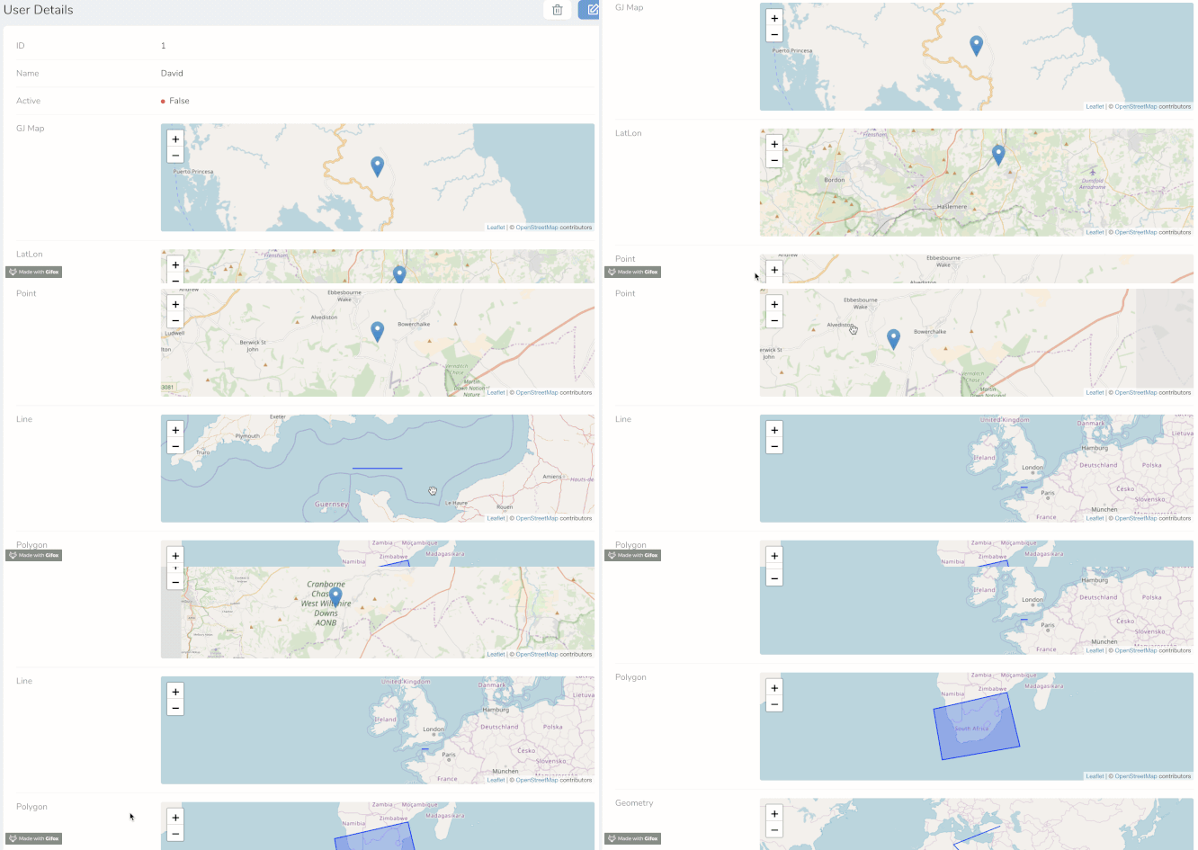
Map Field
This map field currently ONLY shows in details view

You can use this Map Field with three different sort of spatial data:
- GeoJSON String property
- Latitude and Longitude properties
- Latitude and Longitude both in a single text field
-
Core Laravel Spatial Types
- Point
- LineString
- Polygon
- Geometry
- GeometryCollection
- MultiPoint
- MultiLineString
- MultiPolygon To use these core types you need to install grimzy/laravel-mysql-spatial See the section below on setting this up. This can work with other databases, but YMMV.
- You can set the height of the map in px
- The field is disabled in Index and Form views by default
- This is very much a WIP - please submit issues to GitHub
Spatial Types
To specify what sort of spatial data you are passing to this field you MUST set the spatialType() for example
These are the valid Spatial Types
- LatLon
- LatLonField (single field)
- GeoJSON
- Point
- LineString
- Polygon
- Geometry
- GeometryCollection
- MultiPoint
- MultiLineString
- MultiPolygon
Examples
Point
Polygon
GeoJSON
Latitude & Longitude (in seperate fields)
Latitude & Longitude (in single fields)
Set the Height
Setting up the Laravel Spatial Types
You need to install grimzy/laravel-mysql-spatial into your main application
Add the SpatialTrait to your Model
You then also need to set any spatial fields you have set in the Model
Your Model is now ready to process spatial data to Nova
Future Development
- Editing capabilities for all Spatial Types
- View Place Field address on a Map
- Remove reliance on grimzy package from accessing core Spatial Types
- Allow all DB spatial fields to be used
- Customize the map futher
- Tailwind Height classes
- Customise Geometry Styling
- Marker Icon
- Colors, Thicknesses, Opacity
- Basemap
- Streets
- Topo
- Satellite
- Navigation Tools (Compass, Zoom In/Out)
- Alternative Map Providers
- Google Maps
- Mapbox
- OpenLayers


