Download the PHP package arno974/lizmap-altiprofil without Composer
On this page you can find all versions of the php package arno974/lizmap-altiprofil. It is possible to download/install these versions without Composer. Possible dependencies are resolved automatically.
FAQ
Example:
In general, it is recommended to use always a project to download your libraries. In an application normally there is more than one library needed.
- Some hosting areas are not accessible by a terminal or SSH. Then it is not possible to use Composer.
- To use Composer is sometimes complicated. Especially for beginners.
- Composer needs much resources. Sometimes they are not available on a simple webspace.
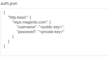
- If you are using private repositories you don't need to share your credentials. You can set up everything on our site and then you provide a simple download link to your team member.
- Simplify your Composer build process. Use our own command line tool to download the vendor folder as binary. This makes your build process faster and you don't need to expose your credentials for private repositories.
Informations about the package lizmap-altiprofil
AltiProfil for Lizmap

Description
This Lizmap module allows you to create topographic profile, either from a raster table stored in PostGIS or an online API such as French IGN data provider.
Installation
Use minimum version 0.5.0 with Lizmap 3.8
Version 0.4.2 is compatible with Lizmap Web Client 3.4 and < 3.8.
You should install it with Composer. If you can't, you must follow the manual installation part.
With Composer
-
In
lizmap/my-packages, create the filecomposer.jsonif it doesn't exist by copying the filecomposer.json.dist. Then launch Composer by specifying the module name to install. - Then go in
lizmap/install/and execute some scripts :
If you are using Lizmap Web Client 3.6 and higher, launch first :
- Then, whatever the version of Lizmap, launch installation scripts :
Go to the configuration part.
Manual installation
- Download the ZIP from the GitHub release page.
- Extract the zip and copy directories
AltiProfil, andAltiProfilAdminin folderlizmap/lizmap-module/ - Modules need to be enabled in Lizmap by editing the configuration file
lizmap/var/config.
For Lizmap 3.4 or Lizmap 3.5, add in the file lizmap/var/config/localconfig.ini.php, in the [module] section,
the reference to these 2 modules. Do not remove references to other modules in this section.
For Lizmap 3.6 or higher, don't modify lizmap/var/config/localconfig.ini.php, launch this command instead:
- Then for any version of Lizmap, launch the installation of the modules with
Configuration
It's necessary to go in the administration panel of Lizmap Web Client to set up the module.
This configuration will create or edit the file lizmap/var/config/altiProfil.ini.php, which might contain for instance :
You can specify your data source. Depending on your datasource, some extra configuration might be needed.
Database
IGN French provider
Override the configuration for a single project
For every project published in Lizmap, for instance my_project.qgs, you can add a new file with extension .alti at the end of the file.
In our example, it would be my_project.qgs.alti.
This file allows you to override schema and table settings (when altiProfil is configued to use database as data source).
For instance
Use-case from a database
To use this module with a database, you should connect to a raster table having a DEM.
You need to add in the file profiles.ini.php (located inlizmap/var/config) the given block :
Cas de l'utilisation à partir de l'API IGN
French only 🇫🇷
En raison de l'absence de continuité de service de l'offre Pro IGN, il n'a pas été possible de tester complément l'intégration de l'API. Les tests effectués ont été réalisés sur la base des exemples donnés dans la documentation.
Il est possible que l'intégration ne soit pas optimale, mais cela devrait tout de même être fonctionnel.