Download the PHP package anthonymartin/geo-location without Composer
On this page you can find all versions of the php package anthonymartin/geo-location. It is possible to download/install these versions without Composer. Possible dependencies are resolved automatically.
Download anthonymartin/geo-location
More information about anthonymartin/geo-location
Files in anthonymartin/geo-location
Package geo-location
Short Description Powerful GeoCoding library: Retrieve bounding box coordinates, distances between geopoints, point in polygon, get longitude and latitude from addresses and more with GeoLocation for PHP
License MIT
Homepage https://github.com/anthonymartin/GeoLocation
FAQ
Example:
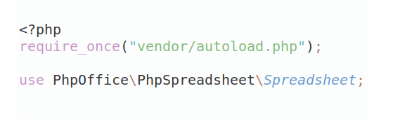
In general, it is recommended to use always a project to download your libraries. In an application normally there is more than one library needed.
- Some hosting areas are not accessible by a terminal or SSH. Then it is not possible to use Composer.
- To use Composer is sometimes complicated. Especially for beginners.
- Composer needs much resources. Sometimes they are not available on a simple webspace.
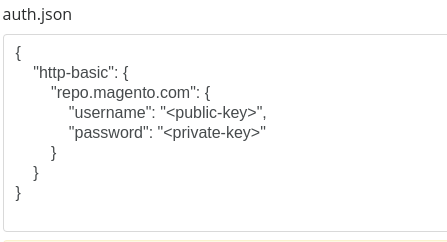
- If you are using private repositories you don't need to share your credentials. You can set up everything on our site and then you provide a simple download link to your team member.
- Simplify your Composer build process. Use our own command line tool to download the vendor folder as binary. This makes your build process faster and you don't need to expose your credentials for private repositories.
Informations about the package geo-location
GeoLocation for PHP
Typed, immutable geographic points and polygons for PHP 8.3+: distances, regions, ellipsoidal geodesics, SQL proximity filters, GeoJSON/WKT, geohashes and geocoding. Geometry is pure PHP, with no runtime Composer dependencies or optional extensions.
2.x remains supported as-is, including PHP 5.4, with security and bug fixes
and no scheduled end-of-support date. ^2.0 stays on 2.x. Moving to 3.0 is optional;
read the migration guide before changing your constraint.
Five examples
Save each example in your application's root directory, beside vendor/.
Coordinates are latitude, longitude in degrees. Units are explicit: km,
kilometers, mi or miles, case-insensitively. Numeric coordinate strings are
accepted; getters return floats. Invalid or non-finite coordinates throw.
Distance and immutable coordinates
Bearings and destinations
Bounding boxes
Circles and regions
Polygons
Point distances use a sphere. Boxes and circles include their boundaries; boxes
handle the antimeridian. Polygon contains() is planar with half-open boundaries.
Use containsSpherical() explicitly for minor great-circle rings crossing the date
line or enclosing a pole. See the guides for geometric limits and accuracy.
Guides
| Feature | Guide |
|---|---|
| Coordinates, immutable polygons, area, centroid, simplification, validation | Geometry |
| Bounding boxes, circles, interchangeable region contracts | Regions |
| Bearings, interpolation, WGS-84 Vincenty solver and accuracy limits | Geodesy |
| Parameterized MySQL, PostgreSQL and SQLite proximity queries | SQL |
| GeoJSON and WKT codecs, coordinate order and unsupported shapes | Formats |
| Google, Nominatim, reverse geocoding, PSR-18 HTTP and test doubles | Geocoding |
| Encoding, neighbors and bounded region coverage | Geohashes |
| Reproducible measurements | Benchmarks |
Geocoding uses native cURL or an injected PSR-18 client. Credentials, provider policies, caching and rate limits are described in the geocoding guide.
Contributors: read Development. CI runs PHP 8.3–8.5, the documentation examples, PHPStan max and dependency/purity checks. See CHANGELOG.md for release history.
MIT licensed; see LICENSE. Created by Anthony Martin. Some original geometry code derives from Jan Philip Matuschek's bounding-coordinate work.